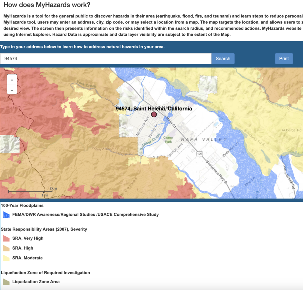
Water influences both Flooding and Fires. The screenshot below shows Flooding and fire hazards for the St Helena area. You can get a more detailed map by entering your address at the California Office of Emergency Services My Hazard Mapping Tool. These maps show relative hazards as identified by the California Office of Emergency Services. You can see that the City of St Helena has threats from both Wildfires and Floods.
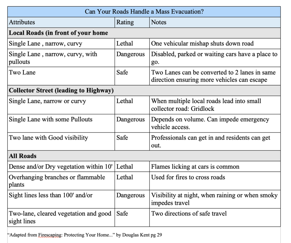
Given these hazards it is important to look specifically at where you live should there be a need for you to evacuate. We cannot change existing developments but in new developments a grid pattern is recommended over Cul-de-sac and dead end streets.
Please help out first responders by making sure your address is visible from the street. Numbers on the curb and house are ideal. If the house is not visible from the street consider reflective mailbox numbers.
More information on Firescapping your home is in the book by Douglas Kent available at the St Helena Library Firescaping: Protecting Your Home with a Fire-resistant Landscape.